In our latest product release we introduced geospatial metadata functionality for Figshare repositories and portals.
This powerful new feature allows researchers to map and describe the geographical context of their research outputs. Understanding where research data originates can be crucial. From ecological studies tracking biodiversity to archaeological digs uncovering ancient sites, for a broad range of disciplines location data enriches research, enhances discoverability, and fosters greater reuse.
Rich contextual understanding – Knowing the ‘where’ behind the data provides invaluable context, allowing others to better understand its applicability, limitations, and implications.
Empowering diverse disciplines – This feature is invaluable across a wide range of fields including ecology, archaeology, geology, environmental science, urban planning, public health, and many more.
Flexible and granular control – The geospatial metadata field can be configured in the same way as any other custom metadata field, providing administrators with complete control over its use. Standard controls like ‘Field name’, ‘Guidance text’, and ‘Mandatory’ settings are retained for familiar administrative control.
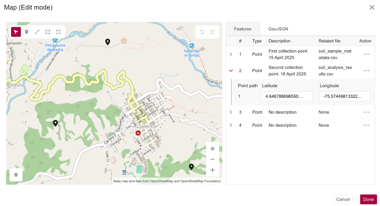
For users who prefer a tabular view, the ‘Features’ table allows for detailed input and editing of vertex coordinates. From the table it is possible to provide a description for a feature and link specific geographical features to associated files within the Item. In this way, users can capture detailed context about the features. Advanced users can directly input, edit, or import GeoJSON, a widely adopted open standard for geospatial data. The use of GeoJSON promotes machine-readability and interoperability.

When interacting with the map, Features table, or GeoJSON tab, changes are reflected dynamically across all modalities. This ensures users have a clear understanding of the representation of their geospatial data.
Related posts
- « Previous
- 1
- 2
- 3
- 4
